History / Wartime map of former Catfirth base discovered
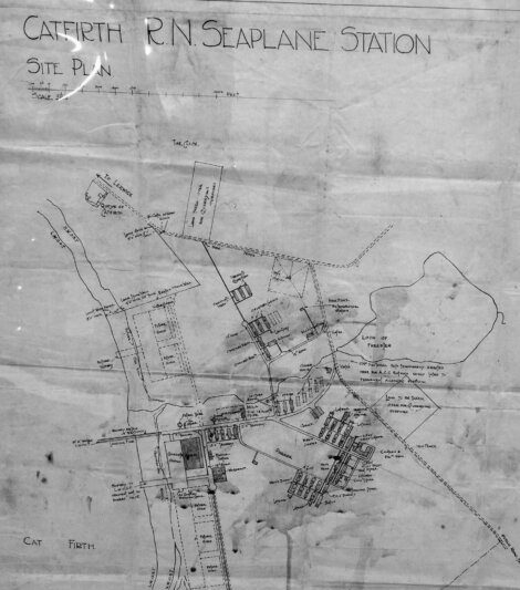
A “LONG forgotten piece of history” has been unearthed in the form of a wartime map which was hand drawn in 1918.
Damien Ristori found the map of the old Catfirth seaplane station whilst looking through his late aunt’s belongings.
The map is now on show at the Puffin Republic shop window in Lerwick until 29 November.
The map had been kept for many years by the late Bobby Georgeson, originally from Catfirth, until he passed away in 1977.
Ristori said it is a “rarity for today’s history enthusiasts and perhaps anyone interested in maps overall”.
The seaplane base was used in the First World War, with the first flight landing in 1918.
It was the most northerly base in Britain for tracking and attacking German submarines.
It ended up housing more than 400 people before closing in 1919.
Become a member of Shetland News
Shetland News is asking its many readers to consider paying for membership to get additional features and services: -
- Remove non-local ads;
- Bookmark posts to read later;
- Exclusive curated weekly newsletter;
- Hide membership messages;
- Comments open for discussion.
If you appreciate what we do and feel strongly about impartial local journalism, then please become a member of Shetland News by either making a single payment, or setting up a monthly, quarterly or yearly subscription.


